| Home | Newsletter | Locations | Diary |
| Indexes |
|
| Travellers Resource |
|
|
|
|
|
Maps |
|
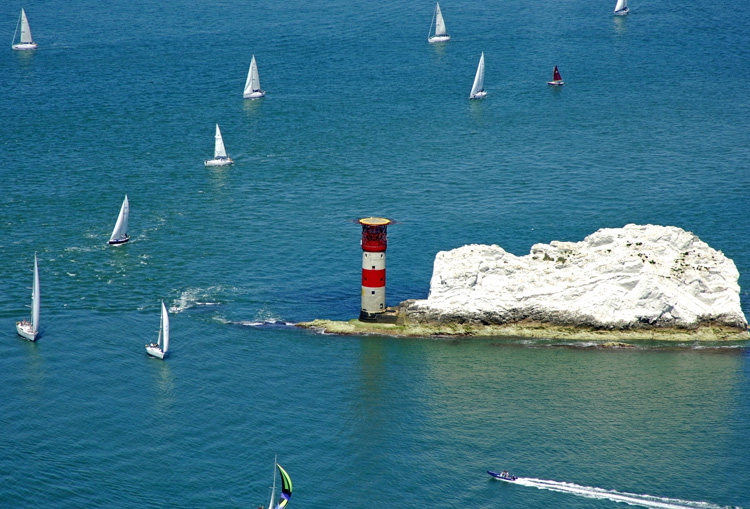
Aerial photo by
Marinas.com
See also the article that we have on the
Isle of
Wight,
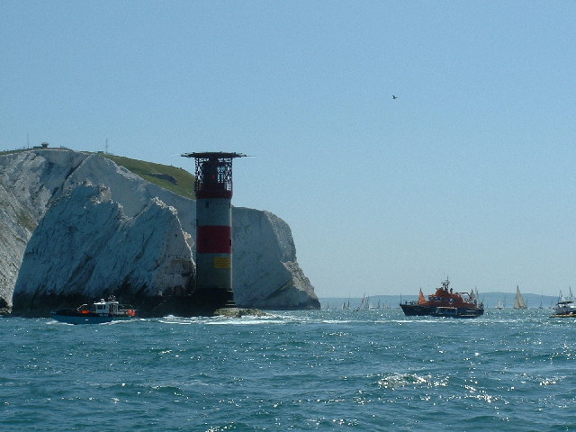
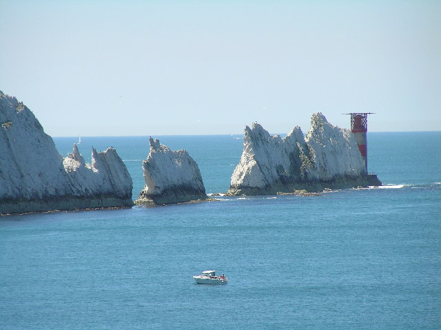
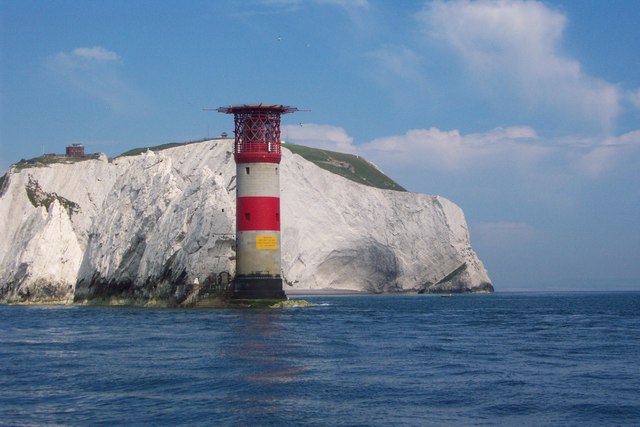
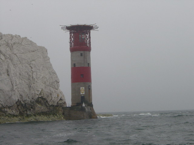
The
needles made mostly of chalk stick out into the edge of the Solent at the
western side on the
Isle of
Wight,
The light at the Needles has two white, two red and one green sector, with one of the red sectors intensified, these are arranged:-
History In 1781 merchants and ship owners petitioned Trinity House for a lighthouse. The patent grated in January 1782 says:-
In
1785 Trinity House erected 3 lighthouses, one at the Needles, the other
two were the
St
Catherine's Point Lighthouse
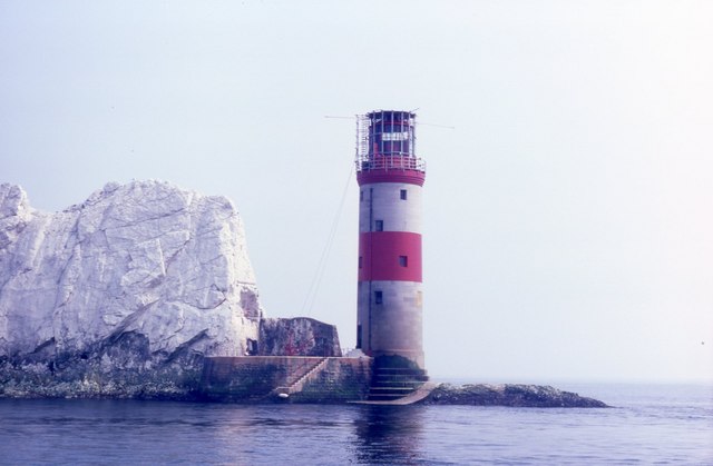
The designs were by R. Jupp, who had been for 30 years surveyor to the East India Company. This first Needles lighthouse was on top of a cliff overhanging Scratchell's Bay, the light was 144m above sea level. It was lighted on the 29th September 1786. However the height gave problems in that it was often obscured by sea mists and fogs and was therefore of limited use to mariners. In 1859 Trinity House planned a new lighthouse to be built on the outermost of the chalk rocks near sea level. It was designed by James Walker and cost £20,000. The circular granite tower has perpendicular sides and is 33.25m high, of uniform diameter with an unevenly stepped base to break the waves and discourage sea sweeping up the tower. The wall varies from 1.07m in thickness at the entrance to 0.61m at the top. Much of the base rock was cut away to form the foundation, and cellars and storehouses were excavated in the chalk. A helipad was built on top of the Needles Lighthouse in 1987 and it was automated in 1994, the keepers left the lighthouse for the last time on 8th December that year. The Needles was the last Trinity House lighthouse powered by 100V DC electricity from it's own generators. To enable the automation to be carried out mains power has been supplied via a sub-sea cable from the Needles Battery, which provides 240V AC power for the new equipment. The original optic with it's arrangements of green and red glass giving the different coloured sectors of light remained after automation but a new three position lamp changer was installed with two 1500W 240V main lamps and a 24V battery powered emergency lamp. The supertyphon air driven fog signal was replaced by two Honeywell ELG 500 Hz directional fog signals controlled by means of a fog detector. The emitter stacks were mounted at gallery level outside the heli-deck structure. In 2010, there was a £500,000 project that rebuilt the base of the lighthouse, which was threatened by erosion by the sea. The Needles is monitored and controlled by Trinity House Centre at Harwich, Essex.
Please let us know any other information that we can add to the Grid or page and any errors that you discover. Before making a long trip to any location it is always wise to double check the current information, websites like magazines may be correct at the time the information is written, but things change and it is of course impossible to double check all entries on a regular basis. If you have any good photographs that you feel would improve the illustration of this page then please let us have copies. In referring to this page it is helpful if you quote both the Page Ref and Topic or Section references from the Grid below. To print the planning grid select it then right click and print the selected area. Please submit information on locations you discover so that this system continues to grow.
|
|||||||||||||||||||||||||||||||||||||||||||||||||||||||
. |
|||||||||||||||||||||||||||||||||||||||||||||||||||||||
|
|||||||||||||||||||||||||||||||||||||||||||||||||||||||
|
|