Home Newsletter Locations Diary

 Indexes

Portal
Magazine4U
Walks Section Heritage Coasts Coastal Paths National Trails Scotland's Great Trails National Parks

Isle of Wight Coastal Path

A Circular route around the Isle of Wight, Hampshire

See Larger Image

Start: Cowes, Isle of Wight, Hampshire

Finish: Ryde, Isle of Wight, Hampshire

Length: 67 miles

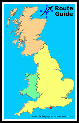
The Isle of Wight Coastal path is a circular route that travels around the while island. It is 67 miles long in total and it is said can be walked in 4 days. It follows public footpaths, minor lands and some sections along roads. It is a varied landscape from white chalk cliffs to quiet estuaries. Almost half of the coastline is designated a Heritage Coast.

If you feel you may not be able to walk the whole distance then it is serviced by buses and trains at various points, except for the section from Blackgang to Brook. If attempting it in smaller sections and you decide to also travel by car there are various public car parks especially in urban areas. Being circular you can start it at any point.

It is well signposted most of the way with signs stating 'Coastal Path' in words, later more modern ones tend to be blue and have a seagull symbol on them.

The ordnance survey maps which cover the route are Landranger 1:50,000 sheet 196 and Explorer 1:25,000 sheet OL29.

There are various tourist websites including this one: http://www.isleofwighttouristguide.com/. There are more listed on Isle of Wight - Further Information.

Broken into manageable routes you could consider:

Cowes to Yarmouth (16 miles)

Cowes is the main entry point to the Isle of Wight with the car ferry port. This section takes you along cliff topes, through villages and woodlands and gives many views of the solent. It starts at the floating bridge on the Cowes side of the River Medina.


The entrance to the River Medina

Anthony Eden See Larger Image

Cowes, Isle of Wight


Location: Cowes, Isle of Wight

Grid Reference:  SZ495960 Ceremonial County: Hampshire
Map Link: Multimap Aerial photo: Google Aerial Photo

Getting there: From the mainland take a Ferry trip across the Solent from Southampton or Lymington.

Website: http://www.cowes.co.uk/zonexml/index

Other useful websites: Isle of Wight Ferries

PDF of this section of the route, with details on what you will see along route.

Notes:


Yarmouth to Brighstone (14 miles)

This section of the walk is the western end of the Island and will take you past the spectacular focal point of the Needles, where you can get a glimpse of the Needles Lighthouse. Other highlights on this section also include Alum Bay, which dates back to 1562 and has a natural coloured variegated cliffs and its colourful sand, and Hanover Point a pine raft fossil forest which becomes visible at low tide and usually populated with cormorants and gulls.

Round the Island Yacht Race June 2006 at The Needles and Needles Lighthouse

Christina Burford See Larger Image

Round the Island Yacht Race June 2006


Location: Yarmouth, Isle of Wight

Grid Reference: SZ355895 Ceremonial County: Hampshire
Map Link: Multimap Aerial photo: Google Aerial Photo

Getting there: From Lymington you can take a car ferry from mainland UK.

Website: http://www.isleofwight.com/yarmouth.html 

Other useful websites: PDF of this section of the route, with details on what you will see along route.

Notes:

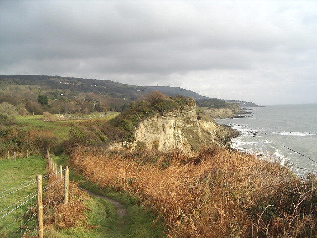
Brighstone to Niton (8 miles)

Starting at Grange Chine a cliff top walk with differing views of the crumbling coastline. There are a number of chines along this section including Whale Chine formed by the rapid erosion of soft clays and sands and Blackgang Chine notable for it's dinosaur fossils and the Blackgang Chine Theme Park.  When you reach Niton on the down there are two buildings known as Pepper Pot and Salt Cellar, there are two uncompleted lighthouses, built in different centuries as well as the existing St Catherine's Lighthouse on St Catherine's Point.

Location: Brighstone, Newport, Isle of Wight

Grid Reference: SZ428827 Ceremonial County: Hampshire
Map Link: Multimap Aerial photo: Google Aerial Photo

Getting there:

Website: http://www.iwight.com/just_visiting/towns/brighstone.asp

Other useful websites: PDF of this section of the route, with details on what you will see along route.

Notes:

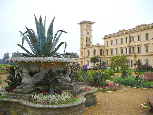
Niton to Sandown (9 miles)

This part of the walk starts high above the sea and goes through Ventnor and areas of National Trust land before taking you along the Victorian promenades of Shanklin and Sandown. Ventnor is a small hamlet and was developed as a fashionable health resort in the 1840's. Today on a visit to Ventnor a look in on the Botanic Gardens 22 acres of plant collections from temperate zones, as well as it's visitor centre.
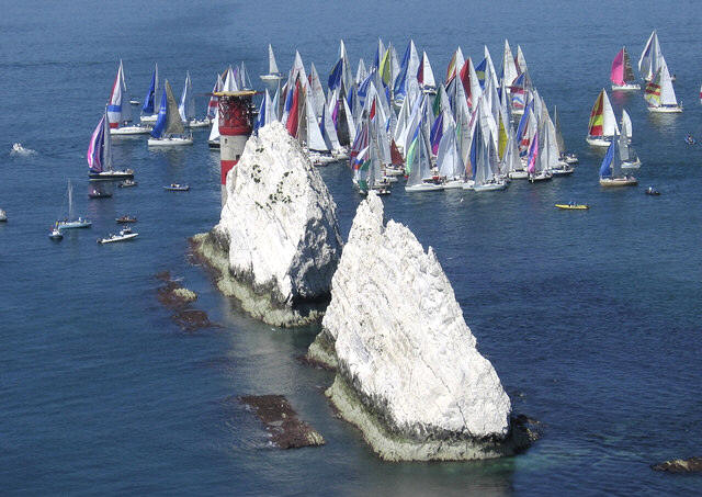
Coast south of Niton looking eastSee Larger Image

Coast South of Niton on the Isle of Wight Coastal Path Michael Wills

Location: Niton, Isle of Wight

Grid Reference: SZ505761 Ceremonial County: Hampshire
Map Link: Multimap Aerial photo: Google Aerial Photo

Getting there:

Website: http://www.wightstay.co.uk/context/niton.html

Other useful websites: PDF of this section of the route, with details on what you will see along route.

Notes:

Sandown to Ryde (12 miles)

This part starts and finishes on Victorian Promenades, but along the way you get to walk over the chalk cliffs of Culver Down and visit Bembridge Harbour and whilst here you might get to photograph the Bembridge Windmill, the last remaining windmill on the island.

Location: Sandown, Isle of Wight

Grid Reference: SZ594838 Ceremonial County: Hampshire
Map Link: Multimap Aerial photo: Google Aerial Photo

Getting there:

Website:  www.iwight.com/just_visiting/towns/sandown.asp

Other useful websites: PDF of this section of the route, with details on what you will see along route.

Notes:


Ryde to Cowes (8 miles)

The final part of this route from Ryde to the final destination at Cowes takes you past

  • abbey ruins and

  • Quarr Abbey home of Benedictine monks,

  • Osborne House the royal residence of Queen Victoria

  • and a modern day vineyard.


Osborne House

puritani35 See Larger Image


Location: Ryde, Isle of Wight

Grid Reference: SZ590919 Ceremonial County: Hampshire
Map Link: Multimap Aerial photo: Google Aerial Map

Getting there: From Portsmouth or Southsea you can take a direct Ferry across 18 minute journey.

Website: http://www.iwight.com/just_visiting/towns/ryde.asp

Other useful websites: PDF of this section of the route, with details on what you will see along route.

Notes:


Please let us know any other information that we can add to the Grid(s) or page and any errors that you discover. Before making a long trip to any location it is always wise to double check the current information, websites like magazines may be correct at the time the information is written, but things change and it is of course impossible to double check all entries on a regular basis. If you have any good photographs that you feel would improve the illustration of this page then please let us have copies. In referring to this page it is helpful if you quote both the Page Ref and Topic or Section references from the Grid below. To print the planning grid select it then right click and print the selected area.

Please submit information on locations you discover so that this system continues to grow.


By: Tracey Park Section: Walk Section Key:
Page Ref: IOW_Coastal_Path Topic: Walks Last Updated: 04/2010

.

This page:

Link directly to this page, with text or the button on right.

Text linking:  Isle of Wight Coastal Path on Photographers Resource

Linking Instructions                            http://www.photographers-resource.co.uk/

Photographers Resource, all the information for the photographer