| Home | Newsletter | Locations | Diary |
|
Indexes |
|
|
|
|
Maps |
|
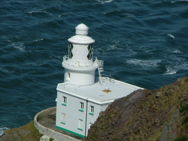
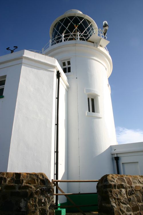
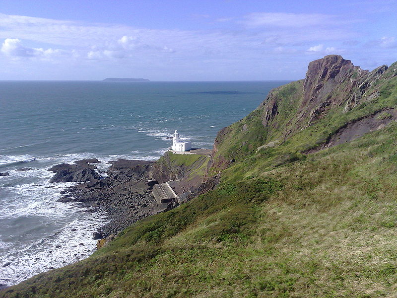
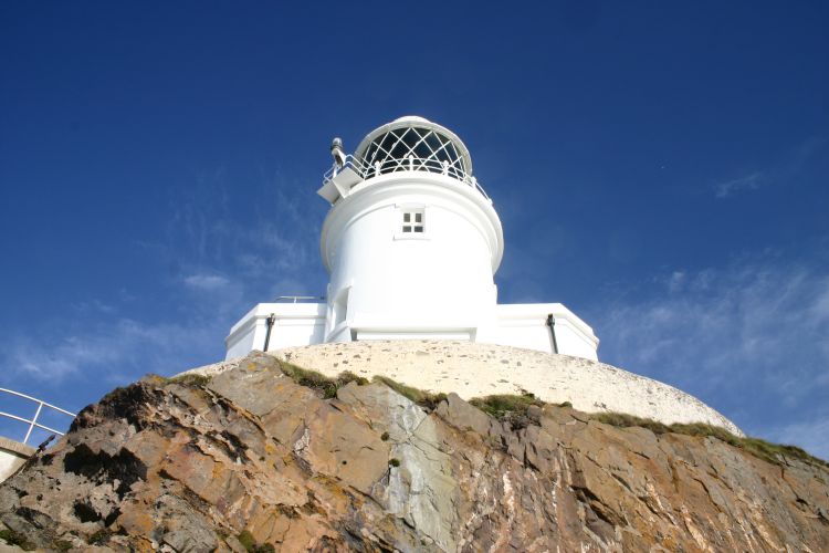
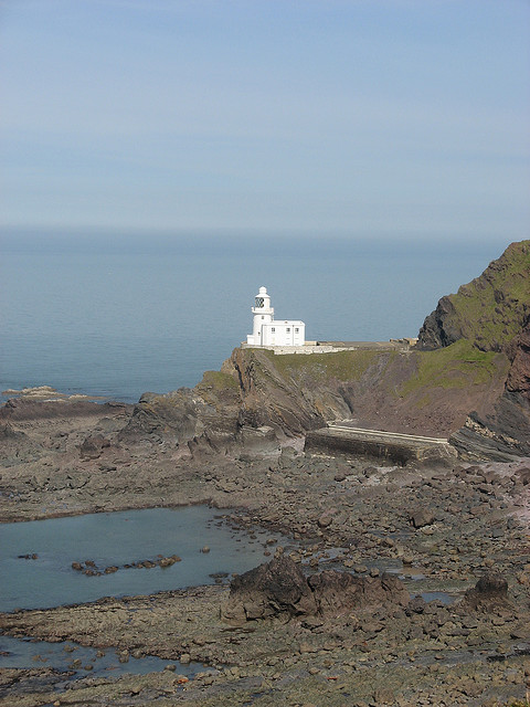
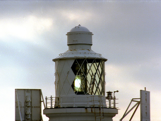
Hartland Point is a 325ft (99m) high rocky outcrop of land on the north western tip of the Devon coast. It is three miles (5km) north west of the village of Hartland. The point marks the western limit (on the English side) of the Bristol Channel with the Atlantic Ocean continuing to the west. This location was known to the Romans as the "promontory of Hercules". The Lighthouse Trinity House have a lighthouse on the tip of the peninsula. Built in 1874 under the direction of Sir James Douglass, the tower is 18m tall with the lamp being 37m above mean high sea level. The lighthouse is on large rock at the tip of the point, and was threatened by the undermining action of the sea to such an extent that rock had to be broken from the cliff head behind the lighthouse, to fall on the beach, and form a barrier against the waves. An action that had to be repeated at frequent intervals as north westerly gales washed away what had been deposited when they coincided with a high spring tide. A permanent barrier, and a sea wall 30 metres long and 6 metres high was built in 1925 to overcome this need. The tower was automated in 1984 and is now controlled from Trinity House Operations Centre at Harwich in Essex.
Prior to automation the lighthouse was built with accommodation for four keepers and their families. The keepers' houses have since been demolished (1984) to make room for a Helipad to be constructed. This was necessary due to the precarious nature of the access road which is liable to frequent rock falls and landslips. In January 2010, Trinity House proposed that the light be deactivated, but after many protests it agreed in May to continue the light at reduced power. Vehicular access is now very difficult and the
gates tend to remain locked. The road to the lighthouse is gated at a parking
area for the
South West Coastal Path.
The large concrete structures immediately to the south of the lighthouse were to provide the keepers with fresh water.
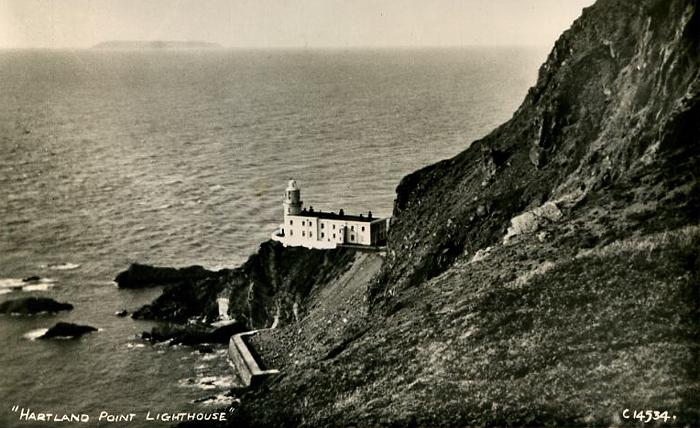
Old postcard, probably 1930's,
shows the lighthouse before the residential units (houses) Coastal Path The
South West Coastal Path
A View from below
Coastguard lookout and radar golf ball A coastguard lookout station is on top of the point near the lighthouse but this is usually unmanned. Also above the point is a a radar station controlled from nearby RAF Hartland Point. This is used for air traffic control of both military and civilian aircraft. The unusual white dome topped structure can be seen from distances of up to 10 miles (16km) from the point.
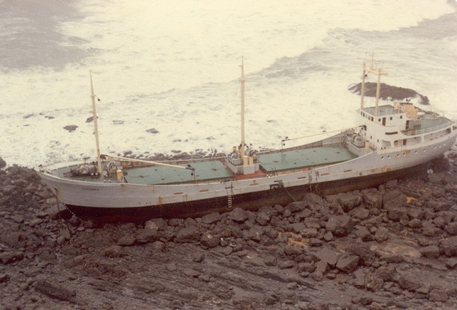
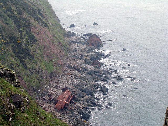
Shipwreck On 31 December 1982 the Panama-registered, Dutch owned MS Johanna was driven aground on rocks less than 400m from the lighthouse during strong gales. The cargo ship was carrying wheat from The Netherlands up the Bristol Channel towards Cardiff. Four of the crew were rescued by a helicopter from RAF Chivenor. Three officers were taken off later in the day by the RNLI lifeboat from Clovelly. The decaying remains of the hull can still be seen.
The MV Johanna, January 1983, as she looked when first wrecked
Less of the ship survives but
parts can still be identified
Please let us know any other information that we can add to the Grid or page and any errors that you discover. Before making a long trip to any location it is always wise to double check the current information, websites like magazines may be correct at the time the information is written, but things change and it is of course impossible to double check all entries on a regular basis. If you have any good photographs that you feel would improve the illustration of this page then please let us have copies. In referring to this page it is helpful if you quote both the Page Ref and Topic or Section references from the Grid below. To print the planning grid select it then right click and print the selected area. Please submit information on locations you discover so that this system continues to grow.
|
||||||||||||||||||||||||||||||||||||||||||||||||||||
. |
||||||||||||||||||||||||||||||||||||||||||||||||||||
|
||||||||||||||||||||||||||||||||||||||||||||||||||||
|
|
