| Home | Newsletter | Locations | Diary |
| Indexes |
|
| Travellers Resource |
|
|
|
|
|
Maps |
|
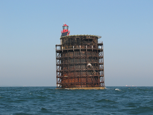
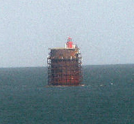
This does not give a good
idea of its size, it is 40 foot across,
Its story, how it came about, Secrets and Wartime Action Its 1916, the British are loosing to much shipping to the German submarines and a secret plan is created code named M-N, this is to create a series of twelve giant fort towers, that will support steel anti submarine nets. This will go from Dungeness to Cap Gris Nez, protecting the Dover straights. Guns mounted on the towers and surrounding mines would protect the constructions from enemy intervention and destroy enemy submarines. The Trinity House account says there were going to be 8 towers. The towers were to be 90ft high and 40ft across standing on an 80ft hollow concrete base that could be flooded to put it down into position. The design was by civilian designer, Mr G. Menzies. In June 1918, they eventually got around to sending a detachment of Royal Engineers to supervise the creation, everyone involved were sworn to secrecy. Two large steel towers were constructed, locals explained them as being like giant multi tiered wedding cakes while being constructed. but being more like a square shape around a round core when nearing completion. 3,000 civilians and 5,000 Army personnel are said to have been involved. By the time anti submarine equipment was installed the cost of the first two 92ft high towers had reached 2.5 million, a huge sum in those days. On the 11th November 1918 the first was completed. Then the First World War and the project stopped. The lightship warning of the Nab rocks was in need of replacement, and the idea was put forward that instead of having a new ship, to take one of the towers, now with no purpose, and stand it on the sea bed to replace the ship. Sunday 12th September 1920, it was towed 41 miles into position by 5 Admiralty tugs or according to Trinity House account, 2 paddle wheel tugs. The Nab Tower, as it now became called, settled onto a sand spit close to the Rock, the valves were opened to allow sea water to flood the vast tanks. It slowly sank to its resting place with a final groan and jerk coming to rest with a three degree tilt from the vertical, leaning to the north-east. It still stands at the same angle. The second tower stayed in Shoreham Harbour until 1924, then was disassembled, taking 9 months to pull it apart. The Nab Tower had space inside for a hundred military personnel, and was converted for use as a lighthouse housing a crew of 4. By the 1960's there were three keepers, a Principal and two Assistants, each serving two months on and one month off. One of the keepers at the time recounts "In addition to normal pay, for me 11 pounds per week, we were paid a daily victualling allowance and each keeper purchased his own food from a grocery shop near the Trinity House depot in Cowes. These provisions were delivered monthly by the Trinity House ship which brought the relieving keepers." The keeper left in 1983. In the Second World War it had two anti aircraft guns on it, that is said to have brought down three enemy planes on its own, and one more in combination with firing coming from a ship. In November 1999 the 10,288 dwt freighter DOLE AMERICA collided with it, laden with a cargo of pineapples and bananas. The ship suffered damage and only avoided sinking by running aground and the Nab Tower was severely damaged. Both were successfully repaired. It was automated in 1983 and converted to solar powered operation in 1995. There is an
illustrated article on the Nab Tower and full story by Valerie Martin
Please let us know any other information that we can add to the Grid or page and any errors that you discover. Before making a long trip to any location it is always wise to double check the current information, websites like magazines may be correct at the time the information is written, but things change and it is of course impossible to double check all entries on a regular basis. If you have any good photographs that you feel would improve the illustration of this page then please let us have copies. In referring to this page it is helpful if you quote both the Page Ref and Topic or Section references from the Grid below. To print the planning grid select it then right click and print the selected area. Please submit information on locations you discover so that this system continues to grow.
|
||||||||||||||||||||||||||||||||||||||||||||||||||||||
. |
||||||||||||||||||||||||||||||||||||||||||||||||||||||
|
||||||||||||||||||||||||||||||||||||||||||||||||||||||
|
|