| Home | Newsletter | Locations | Diary |
| Indexes |
|
| Travellers Resource |
|
|
|
|
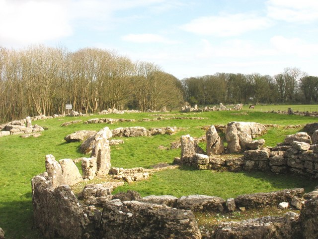
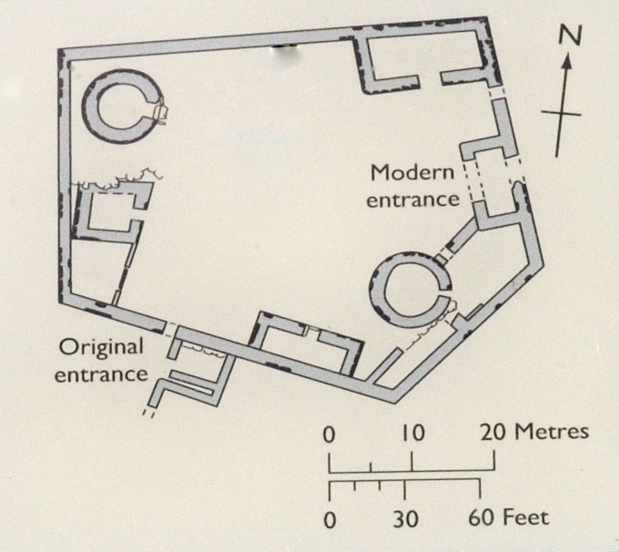
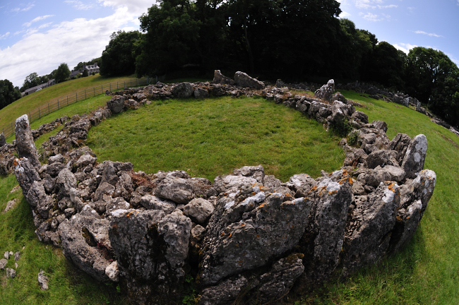
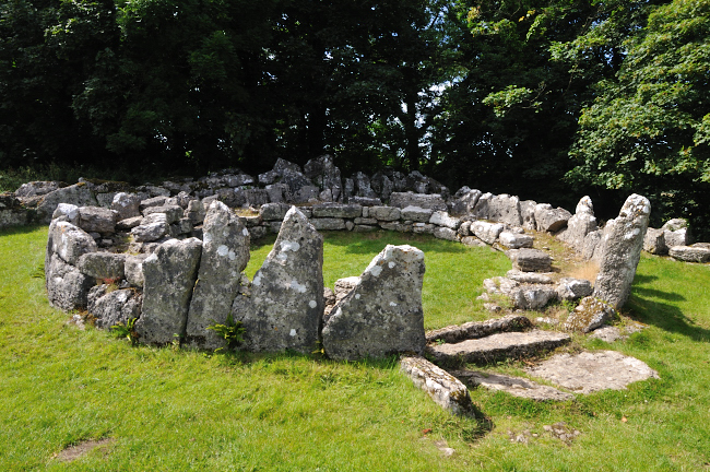
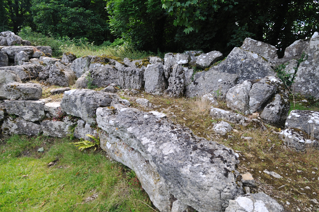
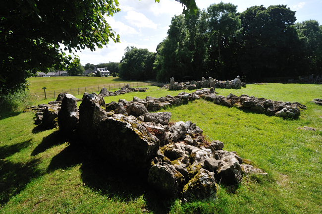
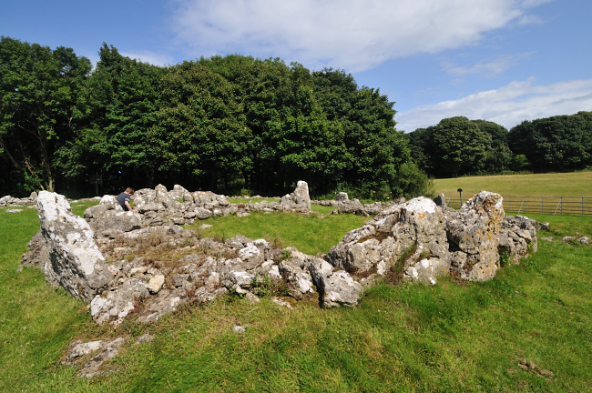
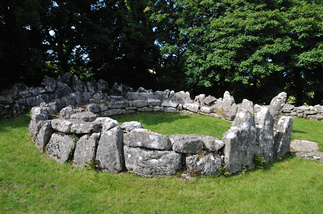
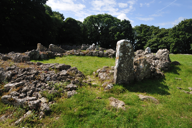
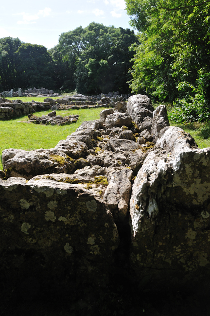
Din Lligwy Hut Circle is a small fortified ancient village site near the east coast of Anglesey, close to the village of Moelfre. Its not known for sure when this was built, we know from coins and pottery found here it was occupied in the 3rd and 4th centuries, in the Roman period of our history. Some think it dates from before this period, placing it in the iron age, but there is little to support this. In exploring the inner buildings its possible to overlook the boundary wall, which is 5ft thick, built from two rows of large limestone slabs with rubble infill. Currently its up to 4ft high, but would have been higher. There are 2 round and a number of rectangular buildings, its generally assumed that the round buildings were accommodation, while the rectangular ones were for animals and for workshops. Currently wall remains from buildings are 3-5ft high. The largest of the round buildings is 21ft (6.4m) across, with walls 7ft (2.2m) thick. Smelting hearths were found in some of the rectangular buildings suggesting they had been used at least at one point for metalworking.
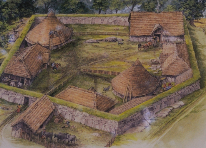
Artists impression of how it used to look
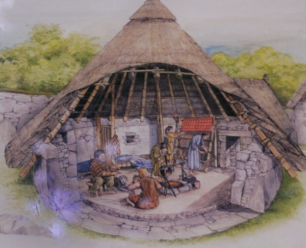
Artist impression of the round houses in use Din Lligwy sits on a low hill with good views over Anglesey and a reliable source of fresh water nearby. The hill is now overgrown with Sycamore and Ash trees, but it is probable that when it was occupied, the village would have had uninterrupted views all around. The modern entrance is through a break in one of the walls but the original entrance was south and next to this, on the outside, is a rectangular building. The general theory is that a small village, or farm existed here in pre Roman times, perhaps going back a very long time, and that in the time of the Roman occupation some of the Roman design features were incorporated into buildings developed for metal working and perhaps animals. The development is strongly influenced by what perhaps they had seen at a Roman fortress, but the people still preferred to live in the style of house they were familiar with, and perhaps already existed. Some suggest that it was at the time the Roman's were leaving or losing influence and the risk of raids was greater that the wall was built around the existing village, the shapes being determined to use existing barn structures and to reduce the amount of wall that had to be constructed. The sign at the site says they think the buildings and wall was up at the same time, this being the later Roman period, but the site had probably been used before, it suggests that this is one of a number of similar fortified farms or small villages within the valley. Although a walled site its defences do not appear to have the capability to withstand a military attack.
Standing in the centre looking towards the left on the plan below. The site layout
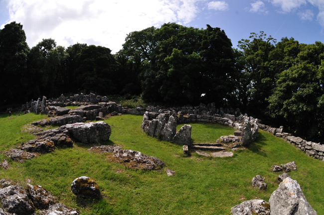
Standing directly in front
of the round house on the right of the plan above, Besides the main structures, shown on the plan and these are represented in the site by substantial solid walls, there are on the ground many more sections of stone walls, most thinner and less complete. Its possible that these are ancillary buildings, animal pens or it could be that some of these are the remains from previous developments on the site.
The
Holyhead Mountain Hut Group
Please let us know any other information that we can add to the Grid(s) or page and any errors that you discover. Before making a long trip to any location it is always wise to double check the current information, websites like magazines may be correct at the time the information is written, but things change and it is of course impossible to double check all entries on a regular basis. If you have any good photographs that you feel would improve the illustration of this page then please let us have copies. In referring to this page it is helpful if you quote both the Page Ref and Topic or Section references from the Grid below. To print the planning grid select it then right click and print the selected area. Please submit information on locations you discover so that this system continues to grow.
|
|||||||||||||||||||||||||||||||||||||||||||||||
. |
|||||||||||||||||||||||||||||||||||||||||||||||
|
|||||||||||||||||||||||||||||||||||||||||||||||
|
|
|||||||||||||||||||||||||||||||||||||||||||||||