Stonehenge
nr Salisbury, Wiltshire
|

Featured Location Guide
"A World Heritage Site" |
|

5,000 years old the same age as the pyramids.
The sun would appear to play a part in its function and some suggest it is a
huge astrological calendar. Some of the huge stones came from hundreds of miles
away.
 
|
 |
Twice as long ago, 8,000BC there are signs of
activity on this site with postholes discovered under the tourists car park. This is the end of the ice age, and the same as the earliest
civilisations found around the world, when the world population is thought to
have been around 5 million. This is before the building of Howick House,
near the village of Howick, in Northumberland said by many to be Britain's oldest
house built in 7,600BC.
|
|
The
meaning and origins of this great monument is unknown
It sits in a field in the middle of
the Salisbury Plain and
from whichever direction you approach it from, it can be seen on the horizon.
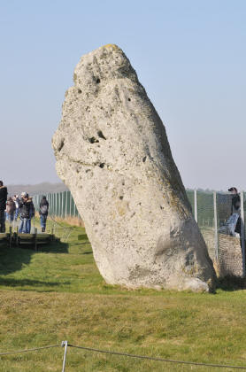
Many people visit it all year round, and although today you cannot climb on or
get too near to the individual stones themselves it is still an impressive site,
and every visitor must be in awe of it's size, purpose and the people who built
it.
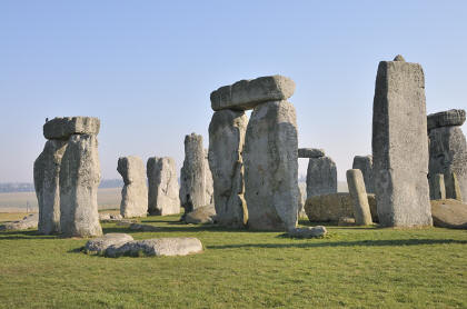
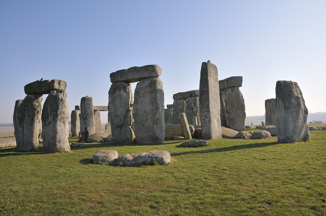
It is of course an ancient stone
circle and it is believed that what is left standing today is the remnants of
the last sequence of monuments erected between 3000BC and 1600BC. The first 'stonehenge'
was a circular bank and ditch with 56 wooden posts (Aubrey Holes) in a ring.
Over the years later monuments used and reused these stones, which were brought
from some great distance.
|
This final phase comprised of
an outer circle of huge hard sarsen stones, believed to be bought from the
Marlborough Downs and they were topped by lintels to make a continuous
ring. Inside this was a horseshoe of large stones, 5 pairs with a
lintel across each pair (trilithons). Smaller bluestones from the Preseli
Mountains, South Wales have been used to make another circle and horseshoe
within the larger structure. All of this held together with tongue and
groove joints and using mortice and tenon.
Its purpose has been of great
debate for many centuries, and over time it has been the focal point in a
landscape of prehistoric ceremonial structures. It's positioning on the
setting and rising of the sun is one of its features but whether this was
because some sort of sun-worshipping culture built it, or it was part of
an astronomical calendar we can only surmise. It is a mystery and one that
probably no one will ever unfold.
The people of this era were amazing using, it is believed, just antlers
and bones to dig pits, banks and ditches. There are artefacts which
show how the people of Stonehenge lived and worked and even contents of
graves have been found, some of these are at museums in Salisbury and
Devizes in Wiltshire. Stonehenge and its surroundings are what remains of
the civilisations of the Stone and Bronze Ages between 5,000 and 3,000
years ago.
There are several stories of stones being
dragged off for other uses in the past and one recovered stone we hear is in
Salisbury museum. It might be interesting to see if others could be found.
Its not the size of Stonehenge that is unique,
there are many other stone circles that are larger, it's the way it is
constructed, nowhere else in the world is the singular lintel structure of
Stonehenge to be found. There are no other surviving examples of the
tongue and groove interlocking construction which has enabled this drystone
building to stand against the passage of time.
There would appear to have been
development in stages over a very long period, and this would have been
unlikely if this was the remains of a passage grave, or the whole
structure permanently buried in some way. The actual area inside is small
compared to the work involved in constructing it, so theories about it
being some grand building also don't seem a logical answer. Although there
are astronomic factors such as alignments of sunrises and turning around
the opposite way, sunsets, and being on the line where the sun and moon are
at right angles at times, some of these factors are common with many
historic monuments.
Click on any picture to see the picture stationery.
There are many burial mounds, long barrows, earthworks and other
monuments still visible in the surrounding countryside, including the
Cursus (SU125425) a long oval earthwork to the North which is believed to have once
been a chariot racecourse. About a third of the world heritage site of
Stonehenge is owned by the National Trust, and this contains over 400 ancient
monuments, we don't have a total for the whole of the heritage site.
Nearby and apart of the heritage site
is
Woodhenge , a site marked with circles of coloured concrete markers
showing where post holes were and
Durrington
Walls (SU150437),
a large earthworks, and thought to be where the builders of Stonehenge
lived. The National Trust also have a 4 mile walk around the countryside starting from
Durrington Walls and visiting some of the other features, you can download
a PDF off
their website. It takes around 2
and half hours and includes
Woodhenge and
Durrington
Walls.
These
two sites are a short drive away. It takes around 2
and half hours and includes
Woodhenge and
Durrington
Walls.
These
two sites are a short drive away.
|
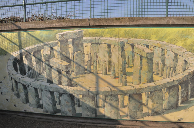
A while back a TV programme reconstructed
Stonehenge in polystyrene in an attempt to show what it might have looked like,
referred to as Foamhenge. You can see photos of this at
http://www.flickr.com/photos/alun/sets/482095/.
A description of the local homes of builders is
discussed at
http://www.youtube.com/watch?v=h2vkLepZlO0&NR=1.
An interesting and some may think crazy theory
is very well graphically presented on you tube, at
http://www.youtube.com/watch?v=gkVIMhUXnec
Many of us were able in the past to visit
this site when it was still completely open and available without charge
or restriction to anyone, to picnic amongst the stones and climb on them
if we chose, and this had the custom for hundreds or years. Of course it
was far quieter then, not a commercial tourist attraction as it is today,
and while we all probably accept that some restrictions are now necessary
with the sheer numbers of visitors, some commercialisation like limiting
the use of photographs taken on the charged sessions, seem off.
Perhaps we should appreciate the many
other sites which so far have avoided the commercialisation that tourism
brings about, and make the most of these while we still are able to. |
|
|
Visiting Today
Today you access the site via booked
timed tickets, but after some major development work the site now has a
visitor centre which includes a large Stonehenge Exhibition, an audio
visual 360 degree view from inside the stones, cafe and shop. Outside the
visitors centre are some Neolithic houses which allow you to explore and
get an idea of how people lived 4,500 years ago. They have been built with
authentic materials and techniques and volunteers in period dress
demonstrate ancient domestic shills like flint knapping, making rope out
of rushes and grinding grain. Getting to the stones is a ?? walk from the
visitor centre or you can take a ride on the visitor shuttle. Once up
close to the stones access is a walk around a path system which allows you
to get photos of the stones from many angles, however on busy days there
can be a lot of people. There is also an audio tour available.
Access amongst the stones, off the public path. You can still book to get access to the stones for
fee, but there are restrictions on photography for commercial uses, and
for website use in these events without paying a larger fee. |
You can click on the smaller
images above to see a larger version.
.
Planning Grid
|
Location: |
Stonehenge,
Wiltshire |
|
Grid Reference: |
SU 122422 - OS
Map 184 |
|
Getting there: |
2 miles West of
Amesbury on junction of A303 and A344/A360 |
|
Access: |
From car park
and following payment of entry fee, on foot via underpass under the road and
then onto marked path. No access onto stones themselves, low level fencing
on edge of path. |
|
Parking: |
Car Park -
Free for National Trust and English Heritage members, seasonal charge for others, refundable on entry. |
|
Facilities: |
Toilets, shop,
restaurant, audio tour, disabled access |
|
Things To Do,
See and Photograph: |
Stone Circle,
plus some views of the local countryside. |
|
What to take: |
Camera,
Tripod, panorama kit, grads |
|
Nature highlights: |
Usually too many people here to see much
wildlife up close. But in the middle of an area with plenty of
opportunities.
Colourful displays of downland flowers around
the area in June and July. |
|
Address: |
Stonehenge
Wiltshire |
|
Postcode: |
SP4 7DE |
|
Telephone: |
0870 333 1181 |
|
Opening times: |
Open daily 9:30am-7pm except for 24-25 Dec closed, 26th Dec and 1st Jan
10am-4pm. Also may be some restrictions from 20-22 Jun due to Summer
Solstice.
Last Admission 2 hours before closing time.
Access to the stones is now by timed
tickets which have to be booked in advance, including for English Heritage
and National Trust Members. |
|
Charges: |
Free to
English Heritage and National Trust Members. Parking charges are for Members
and Non-Members.
Non Members Adults £16, Child (5-15yrs) £9.60, Concessions £14.40,
Family (2+3) £41.60. Audio Tour £2 or
for families £6. |
|
Photo Restrictions: |
No commercial photography. |
|
Other Restrictions: |
Except on special occasions, visitors are
unable to walk amongst the stones when open to the public. See under opening
times. |
|
Special Needs Access: |
Reserved parking for disabled drivers is
available close to entrance. Ticket office reached by short, sloping tarmac
path. |
|
Special Needs Facilities: |
Toilets: WC adapted for wheelchair users in
large toilet block at far end of car park.
Shop: Level access.
Refreshments: Light refreshments are available from the Stonehenge Kitchen.
Braille and large print guides are available
on request |
|
Children Facilities: |
All inspiring site for children and the free
guided tour in a wand, enthrals some. But they have to keep to the paths and
visitor numbers can be large and queues quite long at times. |
|
Dogs Allowed: |
Guide and hearing dogs only |
|

|
Please let us know any other information that we
can add to the Further information and Planning Grids or page and any errors that you discover. Before making a long trip to any location it is always
wise to double check the current information, websites like magazines may be
correct at the time the information is written, but things change and it is of
course impossible to double check all entries on a regular basis. If you have
any good photographs that you feel would improve the illustration of this page
then please let us have copies. In referring to this page it is helpful if you
quote both the Page Ref and Topic or Section references from the Grid below. To print the
planning grid select it then right click and print the selected area.
Please submit information on locations you discover so
that this system continues to grow.
|