Chester City Walls
Chester, Cheshire
 |
The city walls are a system of largely intact
defensive walls surrounding the city, and Chester is known as 'The Walled
City'.. The city has been defended with walls since the foundation of the Deva
Victrix fort on the site in AD 79. The current walls are mainly medieval and
Victorian, although the earliest surviving sections date back to at least AD
120, and the most recent section was constructed as recently as 1966. The walls
are a Grade I listed building, and are the most complete city walls in the
United Kingdom.
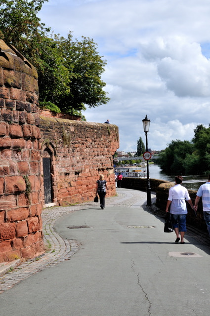
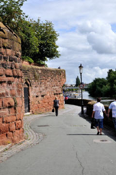
 From beside the River Dee
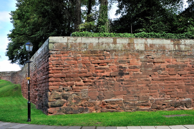
Close to the Roman
Garden
Click on
images to see larger versions |
 |
The first walls were made of wood and earth and
were built to defend the Roman Fort. They were replaced between the 1st and 3rd
centuries with stone walls. The original walls enclosed a smaller area than they
do today. When the Romans left Britain the walls fell into disrepair until 1070,
following the construction of Chester Castle, when they were extended towards
the river. During the English Civil War, Chester was a Royalist stronghold and
the siege engines and cannons used by the Parliamentarians caused much damage
with many sections being breached, and they stayed in much the same state until
the Georgian period when they were repaired and renovated to create a promenade.
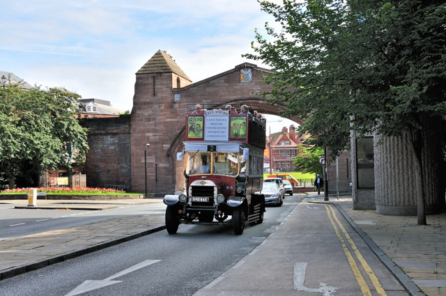
During this time many of the towers and gatehouses were removed to give free
movement along the entire circuit. The Eastgate Clock was added in 1899 to
commemorate the Diamond Jubilee of Queen Victoria. The last change made was in
1966 when St Martines Gate was built to allow the A5268 to pass through the city
and create the Chester ring road.
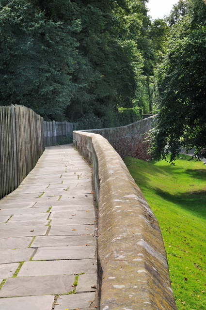
| Today, as the City has grown it no longer
surrounds the whole of the city, but the walls do form an almost complete
circuit of two miles around the historic part, the only breaks being at the
entrance to the car park of Cheshire County Hall building and at Grosvenor Road.
There are various entry points including at Newgate Street, in The Groves, by
Chester Castle and others. From the section running over Newgate Street you can
get a view of the Roman Amphitheatre. A walk around takes about an hour or
longer if you stop off to take in some of the other highlights of the city such
as the Rows, Cathedral, Roman Gardens, Roman Amphitheatre, Groves, River Dee,
Castle, Old Port and Canal. Various vantage points give good views across the
city and on good visibility days from the Western walls you can get panoramic
views of the Clwydian Hills of North Wales. Along the walls at various points
there are metal panels that tell stories about different parts of the route, but
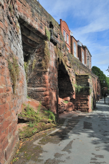
also help you identify which part of the city you are at. A number of remnants of the Roman Wall can be
seen at various points, but the best preserved at on the Eastern side of the
Northgate, the best view of them is to descend the wall and stand on the viaduct
across the canal and look eastwards along the wall. The City Walls Trail
website, listed below, gives more historical details on the wall, but also has a
number of pages which has broken the wall down into sections and explains what
you might see on that section of the wall. They also have a Heritage Trail PDF
file which highlights 43 points around the wall and gives an idea of walk time
for the sections. |
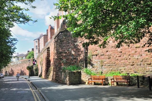
On the Wall by the Castle |
Note: In 2008 a part of the walls
collapsed so a short section has been closed for repairs, however a diversion
route has been set up until the repairs are complete. Chester City Council
manage and look after the walls today.
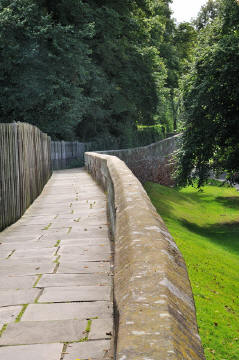
Various Views from different points on the
River Dee side of the wall
.
Planning Grid
|
Location: |
Chester City Walls, Chester |
|
Grid Reference: |
SJ402661 (for the
access point near the Castle) |
|
Getting there: |
From the M56 take the M53 towards Chester and
follow the signs to the City Centre. Following the tourist signs to the
Castle will get you to a large Pay and Display Car Park off Castle Drive
from where you can get access to the Walls. |
|
Access: |
Via a number of entry points around the city
walls, a good start point is via the Car Park off Castle Drive on Grosvenor
Street. |
|
Parking: |
Various locations around the city, including a
large Car Park off Castle Drive |
|
Facilities: |
No facilities on the wall itself |
|
Things To Do,
See and Photograph: |
|
|
What to take: |
|
|
Nature highlights: |
|
|
Address: |
Chester City Centre |
|
Postcode: |
|
|
Telephone: |
01244 324 324 (Chester City Council) |
|
Opening times: |
Any reasonable time |
|
Charges: |
Free |
|
Photo Restrictions: |
None |
|
Other Restrictions: |
|
|
Special Needs Access: |
Wheelchair Access Map
 Gives idea
where you can get onto the walls, many of the access points are steps. Gives idea
where you can get onto the walls, many of the access points are steps. |
|
Special Needs Facilities: |
None |
|
Children Facilities: |
None |
|
Dogs Allowed: |
Yes |
|
CIN Page Ref: |
chester_walls |
Date Updated: 08/2008 |
|

|
Please let us know any other information that we
can add to the Further information and Planning Grids or page and any errors that you discover. Before making a long trip to any location it is always
wise to double check the current information, websites like magazines may be
correct at the time the information is written, but things change and it is of
course impossible to double check all entries on a regular basis. If you have
any good photographs that you feel would improve the illustration of this page
then please let us have copies. In referring to this page it is helpful if you
quote the CIN Page Ref at the bottom of the Planning Grid above. To print the
planning grid select it then right click and print the selected area.
Please submit information on locations you discover so
that this system continues to grow.
|