| Home | Newsletter | Locations | Diary |
| Indexes |
|
| Travellers Resource |
|
|
|
|
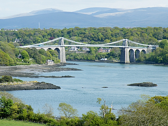
Today there are two bridges that cross to
Anglesey over the Menai Straits, the Menai Suspension Bridge and the later and much modified
Britannia Bridge
Prior to the bridges, travel to Anglesey from the mainland could be hazardous and while on occasions when the tides were low it was possible to walk across, as the water at this time is only 18 inches deep, for much of the time its difficult due to sand banks, and tricky currents and 4 tides a day in this area. Ferries crossed the Menai Strait at various places in those times and numerous boats capsized or ran aground, often with loss of life. In 1785 a boat carrying 55 people became stranded on a sandbar in the middle of the southern end of the Strait. Attempts to refloat the boat left it swamped. The alarm was raised and rescuers set off from Caernarfon, however, the combination of high winds, nightfall and the fear of also running aground meant that the rescuers could not approach the sandbar. Night fell, the tide rose and of those stranded on the sandbar, one survived, the rest were swept away. It is said that the driving force to
construct the bridge came about through the
Act of
Union in 1800,
Work on developing a through road from London
to Holyhead was started far before this and we know Thomas Telford's first
bridge was constructed when he became County Surveyor for Shropshire and
constructed a bridge over the River Severn at Montfort to carry the London to
Holyhead road in 1790. He built at least a further 40 bridges in Shropshire
before taking on many more briefs. By the time he came to look at the bridge for
the Menai Straits he had already created many, including completing in 1805, the
highest and longest aqueduct, 1000ft long and 133ft high in
Denbighshire,
the
Pontcysyllte Aqueduct,
Thomas Telford was given the task of improving a difficult section of route from London to Holyhead and along the way he needed a number of bridges, the largest of these being the one to cross the Menai Straits and a second major crossing at Conwy, both of these, like Robert Stephenson who was to also cross these two later, he chose to use the same technique. There was a lot of opposition to this including from ferry owners and tradesmen in the ports, as well as other ship owners who were concerned that the straits should be left open. The Royal Navy was also keen to keep the straits upon to their ships and insisted that a 100ft, (30m) of headroom was to be available on a high water slack tide. Part of his brief to build a bridge was that he had to have at all times 100ft of clear space under the main span, to allow for the passage of the tall sailing ships that plied the Strait, which not only meant a tall bridge but also no scaffolding being allowed to construct it.
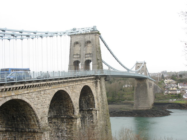
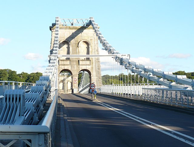
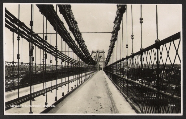
The decision to create a suspension bridge was a brave one, although there had been several earlier suspension bridges, none as far as I can determine had actually lasted long, most failing very quickly. Most of those that had failed were also far smaller than what was needed here. So it was of a type that had not worked in other places, larger and higher than attempted before. Construction started in 1819 with the towers on either side of the Strait. These were constructed from Penmon limestone and were hollow with internal cross walls. Penmon is near to the north and the stone was brought down by boat. The stonework was finished in 1824. There was a massive 579ft length of road surface between the two towers, that was not supported, other than being suspended from the chains above. Tunnels were driven into solid rock on either shore to anchor the chains. Sixteen huge chain cables were made, each made
of 935 wrought iron bars at Hazeldean's foundry near Shrewsbury in Shropshire.
To avoid rusting, each chain cable was first soaked in warm
linseed
oil.
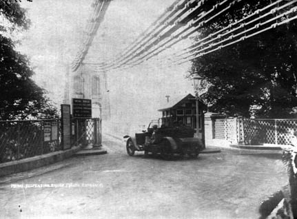
Anglesey end of bridge
Adding the chains started, with the first section of the chain secured on the Caernarfonshire side, drawn up to the top of the eastern tower and left to hang down to the water level. Another chain was drawn up to the top of the tower on the Anglesey side. The central section of chain, weighing 23.5 tons, was then loaded onto a raft, carefully manoeuvred into position between the towers and connected to the dangling chain on the mainland side. While a pipe and drum band played to encourage the workers, 150 men used block and tackle to draw the chain up to the top of the Anglesey tower to complete the span. It was reported that the large crowd that had gathered to watch cheered wildly as the connection was made. The remaining chains were raised in a similar manner over the next ten weeks. Rods were then hung from the chains and bolted to iron bars that were used as the base for the wooden road surface. Onto this a wooden road surface was constructed.
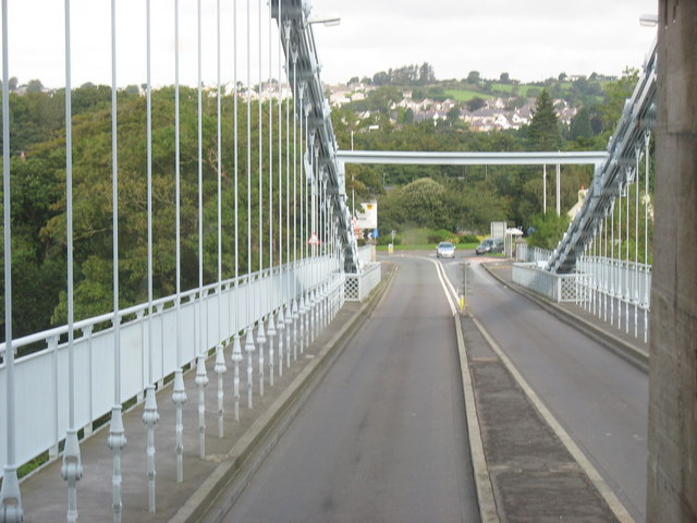
The Old photographs show there were 4 separate groups of chains originally, and two separated carriageways. All later photographs have support only on the outer pair.
Showing anchorage on
the mainland side, also see
how each main piece
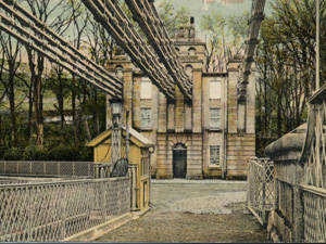
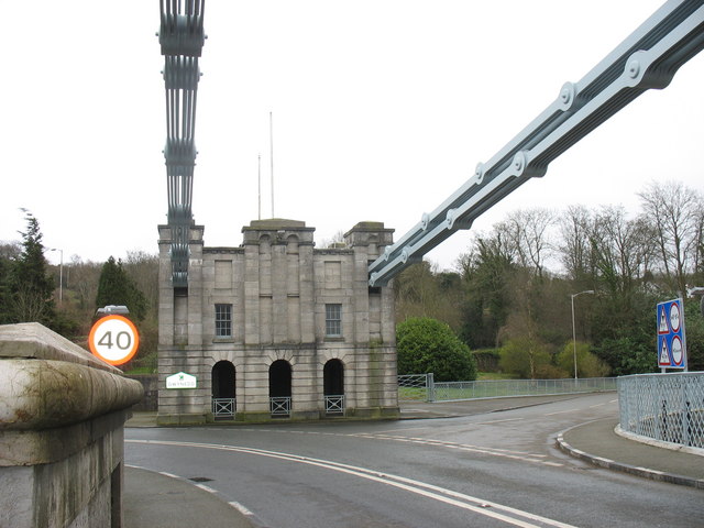
The bridge was opened on 30th January 1826 to a great fanfare. Its completion, along with other improvements to the road by Telford, reduced travel time from London to Holyhead from 36 hours to 27, not bad when you think it was by horse and carriage, as it takes 5.5 hours today. Over the years since a number of changes have occurred. The road surface needed to be repaired when damaged in severe winds in 1839, and the wooden deck was replaced with a steel one in 1893. The original weight limit was 4.5 tons, a lot in the days of horse and carts, but vehicles got heavier and larger. To overcome this overweight vehicles would have to carry their loads over in two or more trips, and bus conductors would regularly have to ask some passengers to walk across. To overcome this between 1938 and 1940 the old iron chains were replaced with new steel ones, all while traffic continued to cross. In the autumn of 1999 the bridge was closed for several weeks to completely replace the road surface and strengthen the bridge. Today the A5 still crosses and the bridge is in
constant use. The
Anglesey Coastal Path
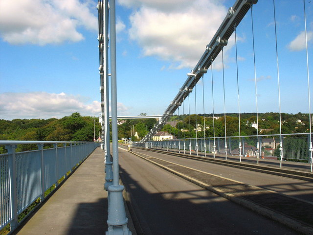
Unlike later bridges this one has sharp turns at each end
Please let us know any other information that we can add to the Grid(s) or page and any errors that you discover. Before making a long trip to any location it is always wise to double check the current information, websites like magazines may be correct at the time the information is written, but things change and it is of course impossible to double check all entries on a regular basis. If you have any good photographs that you feel would improve the illustration of this page then please let us have copies. In referring to this page it is helpful if you quote both the Page Ref and Topic or Section references from the Grid below. To print the planning grid select it then right click and print the selected area. Please submit information on locations you discover so that this system continues to grow.
|
||||||||||||||||||||||||||||||||||||||
. |
||||||||||||||||||||||||||||||||||||||
|
||||||||||||||||||||||||||||||||||||||
|
|
||||||||||||||||||||||||||||||||||||||