Lynmouth Forelands Lighthouse
aka Contisbury Foreland Lighthouse
North of Lynmouth, Devon
|

Location Guide |
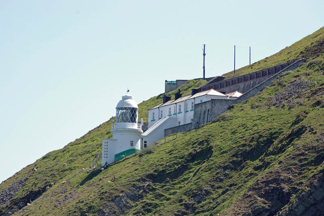
 Photo by
Christopher
Ware Photo by
Christopher
Ware

Part of the
South West Coastal Path

 is
a cliff top walk around the cliffs, 2 miles north of Lynmouth on the
North Devon coast. From this as you go around Lynmouth Foreland,
150 metres above sea you have good views, across to Lundy Island, and
along the coast. On a ledge cut into the hillside below you is Lynmouth
Forelands Lighthouse. Today the keepers cottage is available for holiday
rentals and those staying in it don't have to make the journey along the
hill tops, but can use a winding service road along the hillside. is
a cliff top walk around the cliffs, 2 miles north of Lynmouth on the
North Devon coast. From this as you go around Lynmouth Foreland,
150 metres above sea you have good views, across to Lundy Island, and
along the coast. On a ledge cut into the hillside below you is Lynmouth
Forelands Lighthouse. Today the keepers cottage is available for holiday
rentals and those staying in it don't have to make the journey along the
hill tops, but can use a winding service road along the hillside.
It was in 1900 that Trinity House
built Lynmouth Foreland Lighthouse, also known as the Contisbury
Forelands Lighthouse, as a further aid to navigation in
the Bristol Channel. It is cut into the mountain side, part way up to try
to avoid the fog or low cloud that was experienced in both this area
and led to the nearby
Lundy Island
(Old Light)
being replaced by the
Lundy Island North Lighthouse
and
Lundy Island South Lighthouse.
The round white tower is 15 metres in height,
and is complete with s 1 storey keeper's
house.
The optic is a 1st order dioptric apparatus, 8
panels in 2 groups of 4, revolving on a motor driven mercury float pedestal.
This is 67 metres above sea level.
Photo Mike
Edwards
|
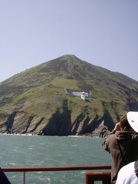
From a ship on the way to Lundy |
Lynmouth Foreland Lighthouse was electrified in
1975 and was automated in 1994. It is now monitored and controlled by Trinity
House at Harwich in Essex.
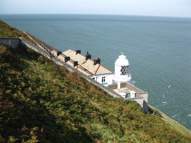
Photo by
Don Cload
Showing why they put this
lighthouse where it is and not on the top.
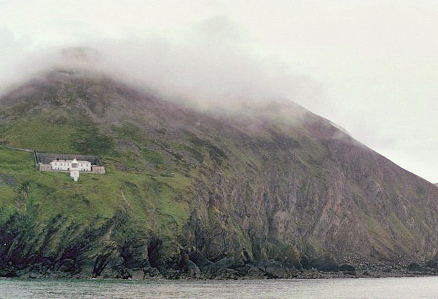
Photo by
Alan Cooper
(edited a bit)
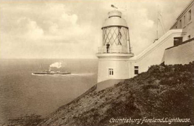
An early postcard from soon
after it was built in 1900, showing a steam ship going past.
Notice that the postcard calls
it the Contisbury Foreland Lighthouse.
Contisbury is a village about a mile away and the area the lighthouse is on, is
called 'The
Foreland' and this comes off a far larger area called 'Contisbury Common'.
Lighthouse information Grid
|
Name: |
Lynmouth Forelands
Lighthouse, Devon |
|
Current status: |
Currently in use |
|
Geographic Position: |
51° 14'.7 N 03° 47'.1 W |
|
Grid Reference: |
SS754511 |
|
Ceremonial County: |
Devon
 |
|
Appearance: |
Round brick tower with lantern and gallery attached to 1 storey keeper's
house. All cut into the side of a steep mountain side. |
|
Map
Link: |
Google Map
|
|
Aerial photo: |
Google
satellite view. |
|
Other photos: |
Geograph
closeup
|
|
Originally built: |
1900 |
|
Current lighthouse built: |
|
|
Height of Tower: |
15m 50ft |
|
Height of light above mean sea level: |
67m 220ft |
|
Character of light: |
4 White Flashes Every 15 Seconds |
|
Character of fog signal: |
|
|
Range of light: |
18 nautical miles |
|
Owned / run by: |
Trinity House

Operator:
Trinity House
Site manager: National Trust
|
|
Getting there: |
Located part way up Foreland Point, a steep headland about 3km (2 miles)
northeast of Lynmouth.
There is a winding service road to the lighthouse, used by cottage guests,
but other visitors generally view the station from above on the
South West Coastal Path
|
|
Access: |
Cottage available for holiday rental and site is therefore available to
guests,
but tower is closed. |
|
Website: |
TH
|
|
Other Useful Websites: |
|
| Routes: |
|
|
Other Relevant pages: |
For more articles, lists and other information
see the
Lighthouses Section
Lighthouse Map of England and Wales


Featured List of
Lighthouses - England and Wales

List of Minor Lighthouses and Lights - England and Wales
|
|
Notes: |
The
keeper's house is available for
holiday rental.
|
|

|
Please let us know any other information that we
can add to the Grid or page and any errors that you discover. Before making a long trip to any location it is always
wise to double check the current information, websites like magazines may be
correct at the time the information is written, but things change and it is of
course impossible to double check all entries on a regular basis. If you have
any good photographs that you feel would improve the illustration of this page
then please let us have copies. In referring to this page it is helpful if you
quote both the Page Ref and Topic or Section references from the Grid below. To print the
planning grid select it then right click and print the selected area.
Please submit information on locations you discover so
that this system continues to grow.
|