| Home | Newsletter | Locations | Diary |
| Indexes |
|
| Travellers Resource |
|
|
|
|
|
Main gateway into fort,
from inside
Looking down on fort layout
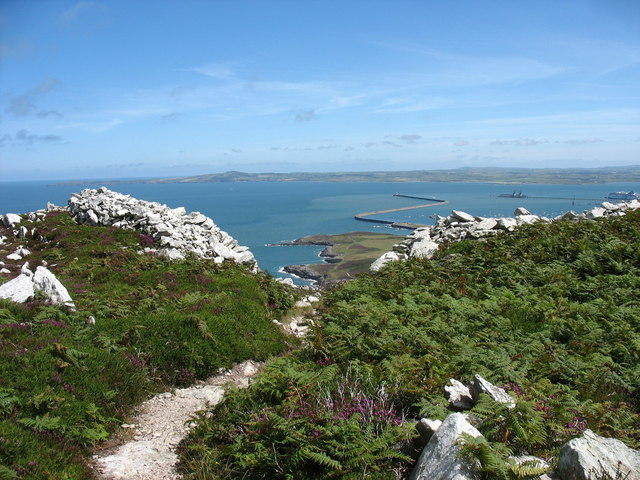
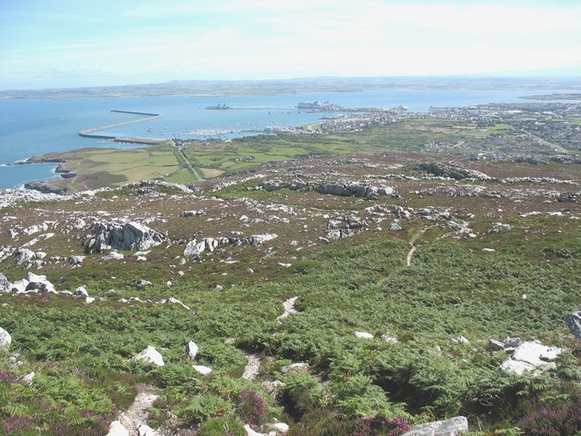
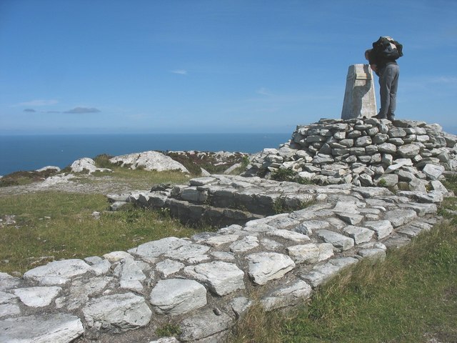
On top of this mountain you have good all round views, which includes being able to see Ireland on a clear day, a view over Holyhead and around and across the Menia Straits. Up here in about the 4th century, the Romans built a tower and a small fort, very little of either now survives. The tower could have been a watch post, or a lighthouse (Pharaos) or both. As a lookout they could see ship movements a long way off, and what was happening throughout the area. As a signalling post they would be able to keep different forts informed of what was happening throughout the region. A lighthouse or Pharos, would also have provided both a warning of dangerous rocks and been a navigational aid. The walls in some parts are over 10ft thick, and this could have been for defensive purposes or supported a tower of some considerable height. The Romans never went to Ireland, to our knowledge, and if they did it was
not to raid, conquer or stay. They had intentions to add it to their empire,
but while preparing for this other demands meant that the forces assembled
were needed elsewhere. It may be that this tower was the main navigational
aid to get to and back from Ireland and the small 3 sided fort on Holyhead,
the Caer Gybi Roman Fort
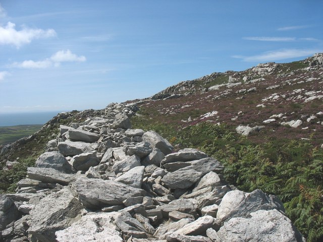
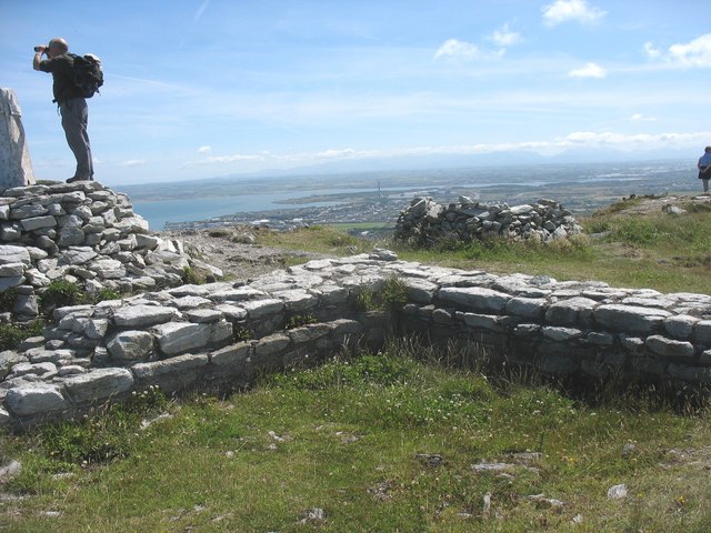
The hillfort, which is situated amongst rocky outcrops, is ideally placed for defence, it is now mostly rubble, but its walls can still be made out, including a large stone rampart on the north and east sides which reaches 3 meters at points. The entrance to the fort was through a rocky gully. The footings of a tower were discovered when the site was excavated, its stones are believed to date from the second century to the fourth century. Today with the exception of the tower its difficult to see any building outlines, although the perimeter wall is still largely identifiable. The area enclosed is around 17 acres, irregular in shape but around 300 metres across. The walls are still, in places, 10ft high and are 13ft wide suggesting there were walkways along the wall tops. At the entrance the walls turn inwards forming an entrance passage. The tower is around 20ft square.
One of the walls
Nestled below Caer y Tŵr is a group of several enclosed huts, named Ty Mawr, but
also known as
Holyhead Mountain Hut Group
To visit this is some climb and you will need a map because it is situated at the rear of Holyhead Mountain. It is not on the tourist trail. The views from such a vantage point are well worth the effort, and up there you are most likely to be alone. The down side can be the strong wind and cold, and on some days the mist that rolls in off the sea. The high sea cliffs amplify the rollers that crash against the land and the shrieking cries of the hundreds of seabirds must sound like the tormented wailings of lost souls. With the wind finding every nook and cranny, it can be an experience.
Excavated Roman remains, this is part of the tower
Anglesey was invaded twice during the occupation of
Britain, little remains to testify to this. Later occupation and garrisoning
can be seen in the ruins mentioned above and Caernarfon, on the
mainland. There is little evidence to show of the Roman campaigns, one of
which must rank as one of the bloodiest operations in the Roman occupation
of Britain, whilst remaining an outstanding example of Roman leadership,
logistics and planning. Information is available on The
Romans
initial invasion
It is also thought that a quayside was incorporated into the fort, under the northeast tower. When the Irish were not raiding, did they trade with the locals and the garrison here?
Please let us know any other information that we can add to the Grid(s) or page and any errors that you discover. Before making a long trip to any location it is always wise to double check the current information, websites like magazines may be correct at the time the information is written, but things change and it is of course impossible to double check all entries on a regular basis. If you have any good photographs that you feel would improve the illustration of this page then please let us have copies. In referring to this page it is helpful if you quote both the Page Ref and Topic or Section references from the Grid below. To print the planning grid select it then right click and print the selected area. Please submit information on locations you discover so that this system continues to grow.
|
||||||||||||||||||||||||||||||||||||
. |
||||||||||||||||||||||||||||||||||||
|
||||||||||||||||||||||||||||||||||||
|
|
||||||||||||||||||||||||||||||||||||